
 Pfarrwerfen
Rosenau am Hengstpaß
Grinzens
Sankt Martin am Wöllmißberg
Sankt Martin am Silberberg
Söding
Felixdorf
Oberpullendorf District
Fließ
Pfarrwerfen
Rosenau am Hengstpaß
Grinzens
Sankt Martin am Wöllmißberg
Sankt Martin am Silberberg
Söding
Felixdorf
Oberpullendorf District
Fließ
Der Weg zum Wein (Weinkeller) on the map, Klosterneuburg, Austria
Photo
Where is located Der Weg zum Wein (Weinkeller)
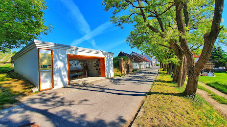
Der Weg zum Wein (Weinkeller) — local attraction, which is located at Kellergasse 26-28, 2102 Hagenbrunn, Austria and belongs to the category — tourist attraction. Average visitor rating for this place — 3.7 (according to 9 ratings, information from open sources and relevant for 2022).
Exact location — Der Weg zum Wein (Weinkeller), marked on the map with a red marker.
You can get directions to Der Weg zum Wein (Weinkeller) on the map from your location.
What else is interesting in Klosterneuburg? You can see all the sights if you go to the city page.
Coordinates
Der Weg zum Wein (Weinkeller), Austria coordinates in decimal format: latitude — 48.32953198067078, longitude — 16.40579512520512. When converted to degrees, minutes, seconds Der Weg zum Wein (Weinkeller) has the following coordinates: 48°19′46.32 north latitude and 16°24′20.86 east longitude.
Nearby cities
The largest cities that are located nearby:
- Bratislava
 (Slovakia) — 61 km
 - Brno
 (Czech Republic) — 100 km
 - Győr
 (Hungary) — 120 km
 - Linz — 150 km
- Graz — 152 km
- Olomouc (Czech Republic) — 157 km
- Székesfehérvár (Hungary) — 201 km
- Ostrava (Czech Republic) — 217 km
- Budapest (Hungary) — 222 km
- Prague (Czech Republic) — 237 km
- Salzburg — 249 km
- Rybnik
 (Poland) — 253 km
 - Bielsko-Biala (Poland) — 257 km
- Pilsen (Czech Republic) — 263 km
- Walbrzych (Poland) — 274 km
- Gliwice (Poland) — 275 km
- Zagreb
 (Croatia) — 277 km
 - Ruda Slaska (Poland) — 280 km
- Zabrze (Poland) — 283 km
Distance to the capital
Distance to the capital (Vienna) is about — 14 km.