
 Staden
Geest-Gerompont-Petit-Rosière
Grote Hut
Sint-Job-in-'t-Goor
Deidenberg
De Pinte
Pussemange
Peruwelz
Barrière de Champlon
Staden
Geest-Gerompont-Petit-Rosière
Grote Hut
Sint-Job-in-'t-Goor
Deidenberg
De Pinte
Pussemange
Peruwelz
Barrière de Champlon
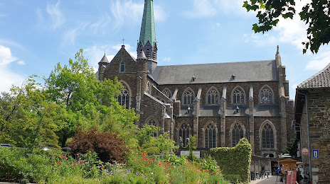
Val-Dieu Abbey on the map, Herve, Belgium
Photo
Where is located Val-Dieu Abbey
Val-Dieu Abbey — local attraction, which is located at Val Dieu 227, 4880 Aubel, Belgium and belongs to the category — monastery. Average visitor rating for this place — 4.4 (according to 2004 ratings, information from open sources and relevant for 2022).
Exact location — Val-Dieu Abbey, marked on the map with a red marker.
You can get directions to Val-Dieu Abbey on the map from your location.
What else is interesting in Herve? You can see all the sights if you go to the city page.
Coordinates
Val-Dieu Abbey, Belgium coordinates in decimal format: latitude — 50.69819389886524, longitude — 5.804226725289831. When converted to degrees, minutes, seconds Val-Dieu Abbey has the following coordinates: 50°41′53.5 north latitude and 5°48′15.22 east longitude.
Nearby cities
The largest cities that are located nearby:
- Liège — 15 km
- Maastricht
 (Netherlands) — 24 km
 - Aachen
 (Germany) — 25 km
 - Namur — 68 km
- Mönchengladbach (Germany) — 75 km
- Cologne (Germany) — 88 km
- Neuss (Germany) — 88 km
- Eindhoven (Netherlands) — 91 km
- Bonn (Germany) — 92 km
- Düsseldorf (Germany) — 94 km
- Krefeld (Germany) — 95 km
- Charleroi — 98 km
- Bergisch Gladbach (Germany) — 101 km
- Solingen (Germany) — 107 km
- Moers (Germany) — 107 km
- Duisburg (Germany) — 110 km
- Tilburg (Netherlands) — 113 km
- Remscheid (Germany) — 114 km
- Mülheim (Germany) — 114 km
Distance to the capital
Distance to the capital (Brussels) is about — 104 km.