
 Staden
Geest-Gerompont-Petit-Rosière
Grote Hut
Sint-Job-in-'t-Goor
Deidenberg
De Pinte
Pussemange
Peruwelz
Barrière de Champlon
Staden
Geest-Gerompont-Petit-Rosière
Grote Hut
Sint-Job-in-'t-Goor
Deidenberg
De Pinte
Pussemange
Peruwelz
Barrière de Champlon
Canal Hensies-Pommeroeul on the map, Saint-Ghislain, Belgium
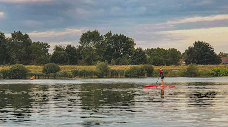
Photo
Where is located Canal Hensies-Pommeroeul
Canal Hensies-Pommeroeul — local attraction, which is located at no data and belongs to the category — -. Average visitor rating for this place — 4.2 (according to 48 ratings, information from open sources and relevant for 2022).
Exact location — Canal Hensies-Pommeroeul, marked on the map with a red marker.
You can get directions to Canal Hensies-Pommeroeul on the map from your location.
What else is interesting in Saint-Ghislain? You can see all the sights if you go to the city page.
Coordinates
Canal Hensies-Pommeroeul, Belgium coordinates in decimal format: latitude — 50.488841054853864, longitude — 3.8058582748861975. When converted to degrees, minutes, seconds Canal Hensies-Pommeroeul has the following coordinates: 50°29′19.83 north latitude and 3°48′21.09 east longitude.
Nearby cities
The largest cities that are located nearby:
- Charleroi — 44 km
- Lille
 (France) — 57 km
 - Namur — 74 km
- Antwerp — 94 km
- Amiens (France) — 125 km
- Liège — 125 km
- Reims (France) — 133 km
- Maastricht
 (Netherlands) — 138 km
 - Breda (Netherlands) — 142 km
- Tilburg (Netherlands) — 151 km
- Eindhoven (Netherlands) — 158 km
- Dordrecht (Netherlands) — 162 km
- Aachen
 (Germany) — 162 km
 - Rotterdam (Netherlands) — 169 km
- 's-Hertogenbosch (Netherlands) — 172 km
- The Hague (Netherlands) — 182 km
- Zoetermeer (Netherlands) — 184 km
- Leiden (Netherlands) — 195 km
- Mönchengladbach (Germany) — 199 km
Distance to the capital
Distance to the capital (Brussels) is about — 56 km.