
 Staden
Geest-Gerompont-Petit-Rosière
Grote Hut
Sint-Job-in-'t-Goor
Deidenberg
De Pinte
Pussemange
Peruwelz
Barrière de Champlon
Staden
Geest-Gerompont-Petit-Rosière
Grote Hut
Sint-Job-in-'t-Goor
Deidenberg
De Pinte
Pussemange
Peruwelz
Barrière de Champlon
Montagne Saint-Pierre on the map, Vise, Belgium
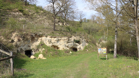
Photo
Where is located Montagne Saint-Pierre
Montagne Saint-Pierre — local attraction, which is located at 4600 Vise, Belgium and belongs to the category — nature preserve. Average visitor rating for this place — 4.6 (according to 99 ratings, information from open sources and relevant for 2022).
Exact location — Montagne Saint-Pierre, marked on the map with a red marker.
You can get directions to Montagne Saint-Pierre on the map from your location.
What else is interesting in Vise? You can see all the sights if you go to the city page.
Coordinates
Montagne Saint-Pierre, Belgium coordinates in decimal format: latitude — 50.78812245755414, longitude — 5.686543925293081. When converted to degrees, minutes, seconds Montagne Saint-Pierre has the following coordinates: 50°47′17.24 north latitude and 5°41′11.56 east longitude.
Nearby cities
The largest cities that are located nearby:
- Maastricht
 (Netherlands) — 13 km
 - Liège — 14 km
- Aachen
 (Germany) — 27 km
 - Namur — 65 km
- Mönchengladbach (Germany) — 71 km
- Eindhoven (Netherlands) — 79 km
- Neuss (Germany) — 86 km
- Krefeld (Germany) — 90 km
- Cologne (Germany) — 91 km
- Düsseldorf (Germany) — 92 km
- Charleroi — 95 km
- Bonn (Germany) — 98 km
- Tilburg (Netherlands) — 100 km
- Moers (Germany) — 102 km
- Bergisch Gladbach (Germany) — 103 km
- Antwerp — 104 km
- Duisburg (Germany) — 106 km
- Solingen (Germany) — 107 km
- 's-Hertogenbosch (Netherlands) — 110 km
Distance to the capital
Distance to the capital (Brussels) is about — 94 km.