 London
Lisburn
Yeovil
Alloa
Newcastle upon Tyne
Cardiff
Scotland
North Yorkshire
Wales
Trent
England
Newcastle upon Tyne
Bath & North East Somerset
Gravesend
United Kingdom
Romsey
Birmingham Airport
Robin Hood Airport
Glasgow Airport
London
Lisburn
Yeovil
Alloa
Newcastle upon Tyne
Cardiff
Scotland
North Yorkshire
Wales
Trent
England
Newcastle upon Tyne
Bath & North East Somerset
Gravesend
United Kingdom
Romsey
Birmingham Airport
Robin Hood Airport
Glasgow Airport
Preston on the map, United Kingdom
Where is located Preston
Exact location — Preston, Lancashire, England, United Kingdom, marked on the map with a red marker.
Coordinates
Preston, United Kingdom coordinates in decimal format: latitude — 53.763201, longitude — -2.70309. When converted to degrees, minutes, seconds Preston has the following coordinates: 53°45′47.52 north latitude and -2°42′11.12 east longitude.
Population
Preston, Lancashire, England, United Kingdom, according to our data the population is — 190,687 residents, which is about 0.3% of the total population of the country (United Kingdom).
Comparison of the population on the graph:
Exact time
Time zone for this location Preston — UTC +1 Europe/London. Exact time — sunday, 4 april 2024 year, 18 h. 31 minute.
Sunrise and sunset
Preston, sunrise and sunset data for a date — sunday 28.04.2024.
| Sunrise | Sunset | Day (duration) |
|---|---|---|
| 05:44 -2 minutes | 20:32 +2 minutes | 14 h. 48 minutes. +4 minutes |
You can control the scale of the map using the auxiliary tools to find out exactly where it is located Preston. When you change the scale of the map, the width of the ruler also changes (in kilometers and miles).
Nearby cities
The largest cities that are located nearby:
- Blackburn — 14 km
- Manchester — 44 km
- Liverpool — 44 km
- Huddersfield — 62 km
- Stoke-on-Trent — 91 km
- Sheffield — 92 km
- Rotherham — 96 km
- Telford — 121 km
- Dudley — 144 km
- Sutton Coldfield — 145 km
- West Bromwich — 146 km
- Birmingham — 151 km
- Sunderland — 152 km
- Leicester — 163 km
- Coventry — 170 km
- Worcester — 177 km
- Northampton — 208 km
- Cheltenham — 210 km
- Belfast — 226 km
Distance to neighboring capitals:
- Dublin
 (Ireland) — 239 km
 - Amsterdam
 (Netherlands) — 531 km
 - Brussels
 (Belgium) — 579 km
 - Paris
 (France) — 649 km
 - Paris (France) — 649 km
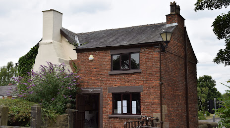
Attractions


Distance to the capital
Distance to the capital (London) is about — 305 km.