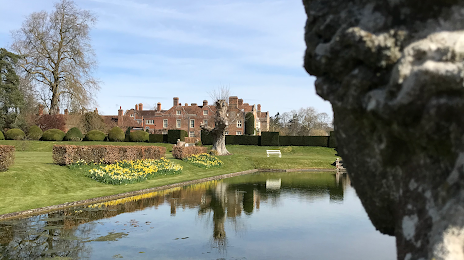
Ottery Saint Mary — Hever
Ottery Saint Mary — Cotts
Ottery Saint Mary — Peterborough
Ottery Saint Mary — Saffron Walden
Ottery Saint Mary — Sterling
Ottery Saint Mary — Fleetwood
Ottery Saint Mary — Scottish Borders
Ottery Saint Mary — Kidderminster
Ottery Saint Mary — Lichfield
Ottery Saint Mary — Llandyrnog
Ottery Saint Mary — Chester
Ottery Saint Mary — Aghagallon
Ottery Saint Mary — Wasing
Ottery Saint Mary — Halfway
Ottery Saint Mary — Jameston
Ottery Saint Mary — West Drayton
Ottery Saint Mary — Ollerton
Ottery Saint Mary — Saint Albans
Ottery Saint Mary — Sunbury-on-Thames
Horton
Lopen
Yeovil
Trent
Mere
West Knoyle
Knook
Great Wishford
Amesbury
Amesbury
Tidworth
Andover
Upper Clatford
Goodworth Clatford
Sutton Scotney
Brown Candover
Preston Candover
Hook
Blackwater
Camberley
Camberley
Sunningdale
Virginia Water
Thorpe
Chertsey
Weybridge
Epsom
Reigate
Merstham
Westerham
Sevenoaks
Comp
Birling
West Malling
Kent
Maidstone
Harrietsham
Lenham
Ottery Saint Mary — Ashford distance, route on the map
Distance by car
Distance between Ottery Saint Mary, England, United Kingdom and Ashford, England, United Kingdom by car is — km, or miles. To travel this distance by car, you need minute, or h.
Route on the map, driving directions
Car route Ottery Saint Mary — Ashford was created automatically. The road on the map is shown as a blue line. By moving the markers, you can create a new route through the points you need.
Passing cities through which the car route passes: Honiton, Horton, Lopen, Yeovil, Trent, Mere, West Knoyle, Knook, Great Wishford, Amesbury, Amesbury, Tidworth, Andover, Upper Clatford, Goodworth Clatford, Sutton Scotney, Brown Candover, Preston Candover, Hook, Blackwater, Camberley, Camberley, Sunningdale, Virginia Water, Thorpe, Chertsey, Weybridge, Epsom, Reigate, Merstham, Westerham, Sevenoaks, Comp, Birling, West Malling, Kent, Maidstone, Harrietsham, Lenham.
Distance by plane
If you decide to take a trip Ottery Saint Mary Ashford by plane, then you have to fly the distance — 294 km or 182 miles. It is marked on the map with a gray line (between two points in a straight line).
Flight time
Estimated flight time Ottery Saint Mary Ashford by plane at cruising speed 750 km / h will be — 23 min.
Direction of movement
United Kingdom, Ottery Saint Mary — left-hand traffic. United Kingdom, Ashford — left-hand traffic.
Difference in time
Ottery Saint Mary and Ashford are in the same time zone. Between them there is no time difference (UTC +1 Europe/London).
Interesting Facts
Information on alternative ways to get to your destination.
The length of this distance is about 0.7% of the total length of the equator.
The cost of travel
Calculate the cost of the trip yourself using the fuel consumption calculator, changing the data in the table.